stdClass Object
(
[type] => Land
[status] => stdClass Object
(
[current] => Active Under Contract
[last] => Active
[changed] => 2025-08-29T08:39:00
)
[ml_number] => 2945566
[price] => stdClass Object
(
[amount] => 5381800
[original] => 5381800
[last_changed_on] => 2025-07-30T18:11:00
)
[listing_flags] => Array
(
[0] => Inspection
)
[available_on] => stdClass Object
(
[$date] => 2025-07-22T04:00:00Z
)
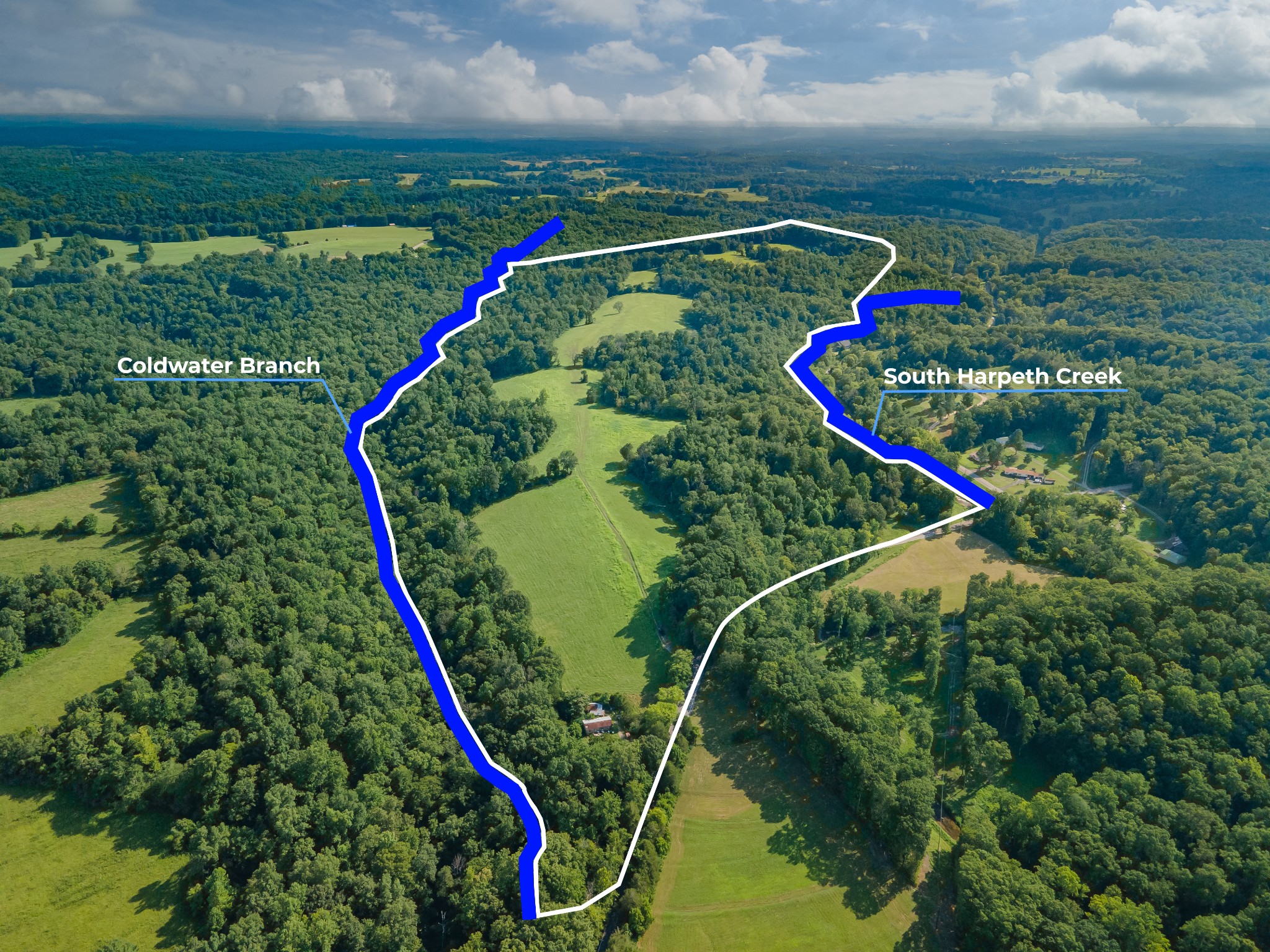
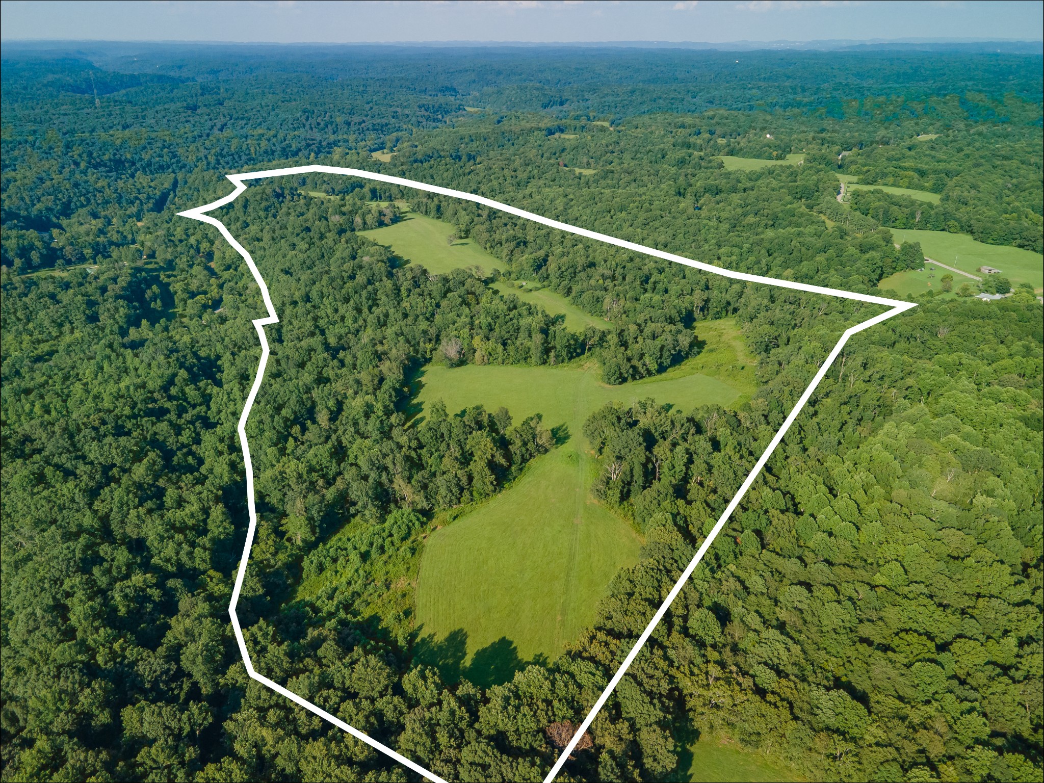
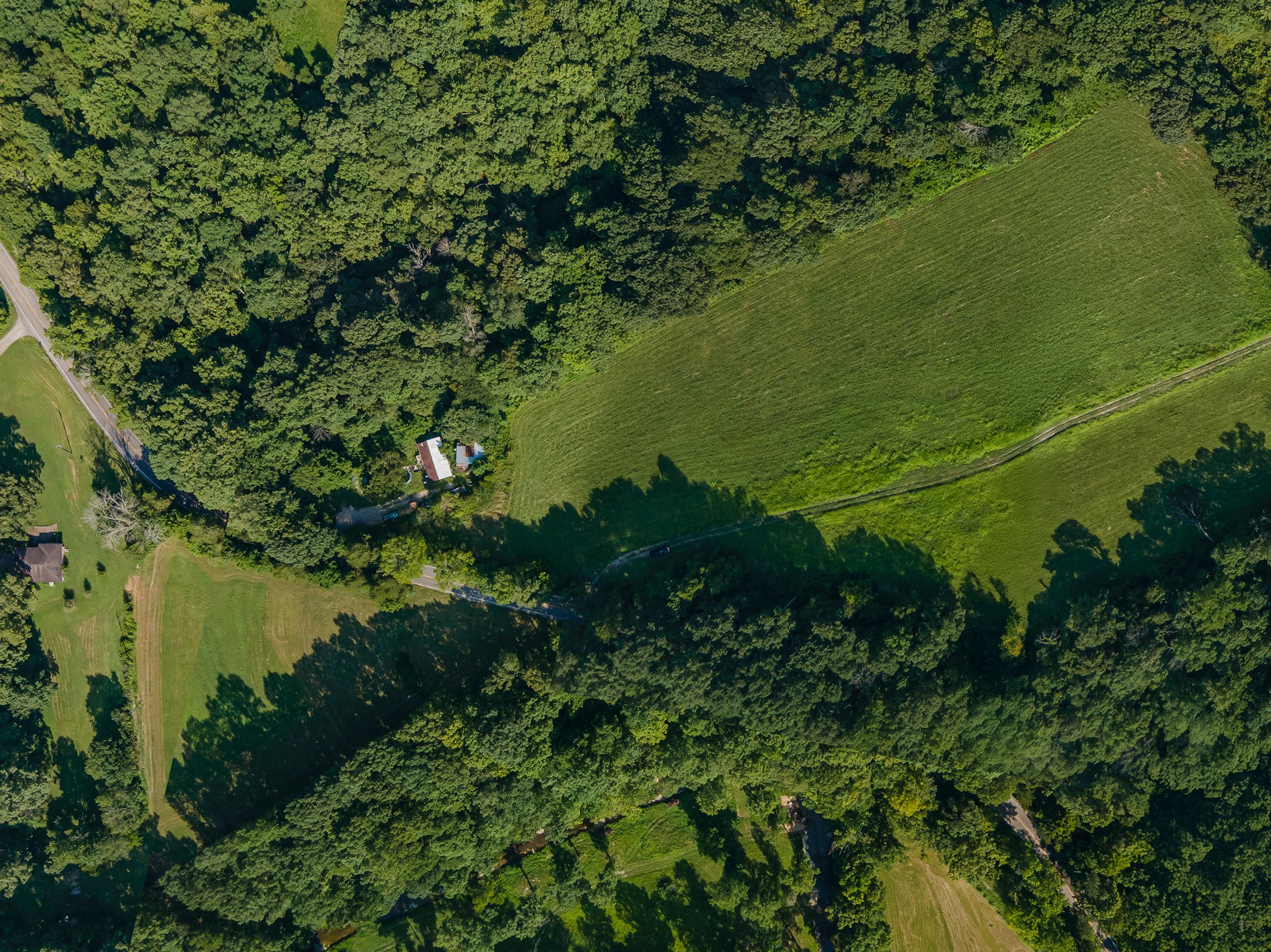
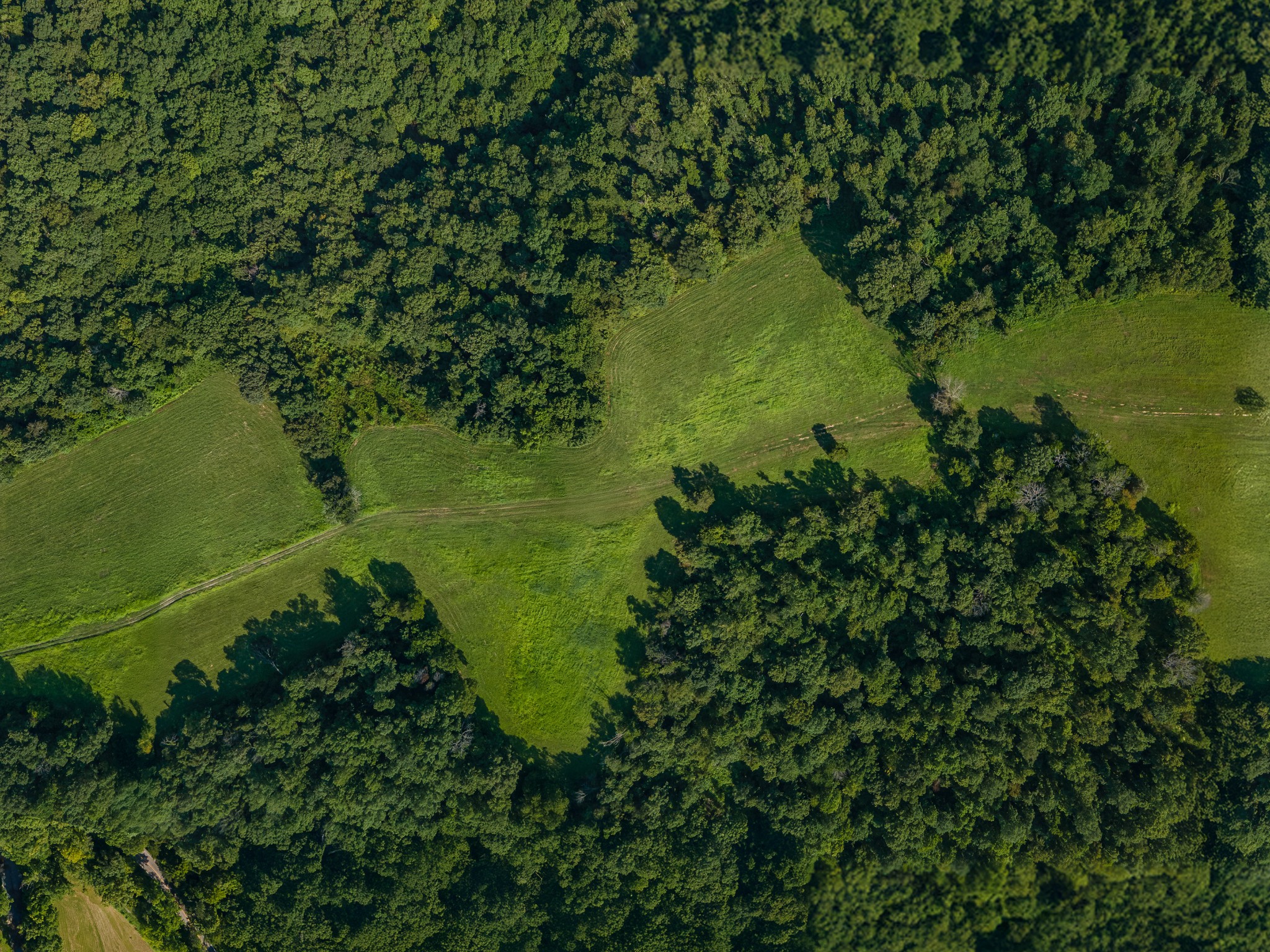
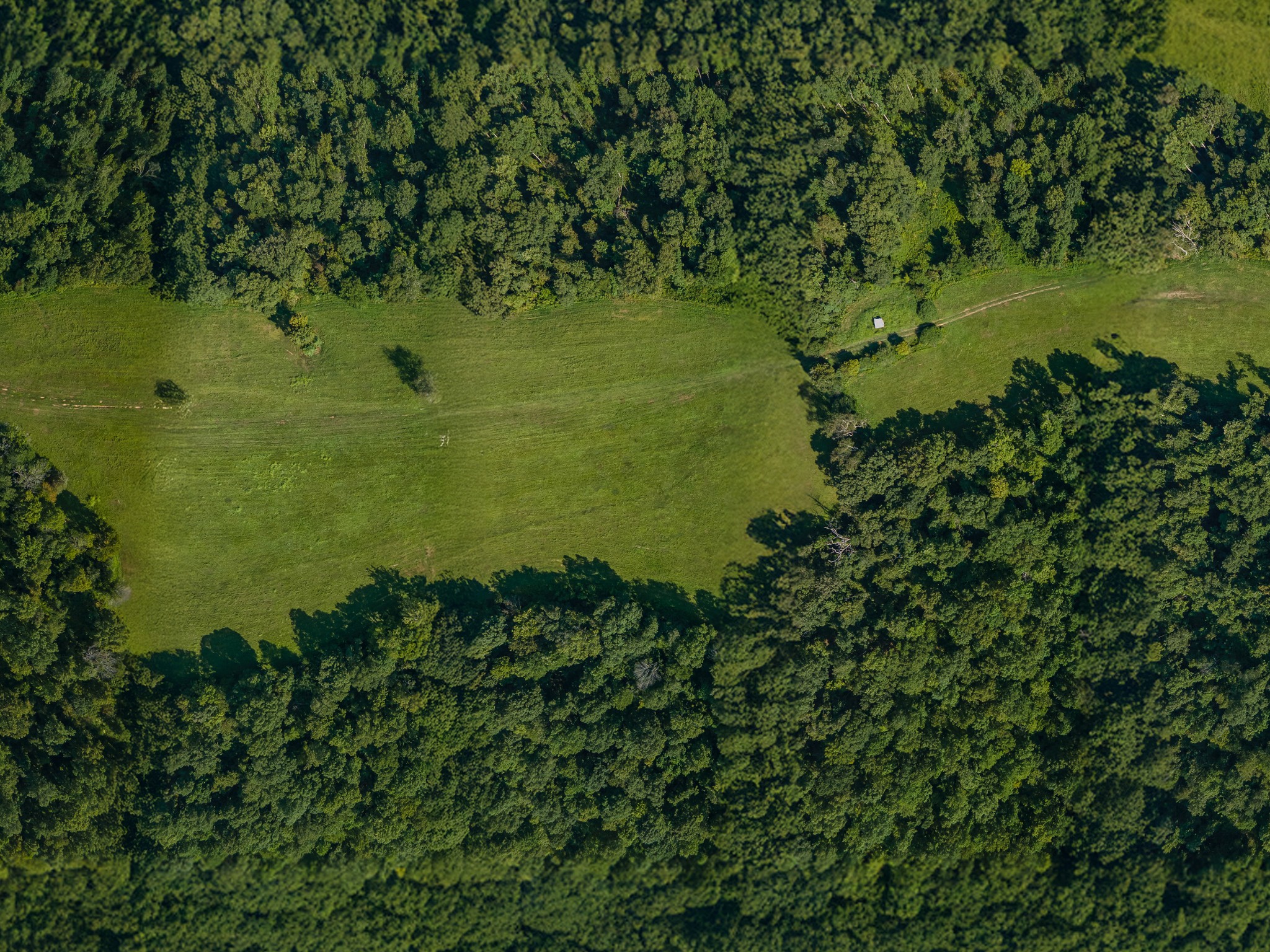
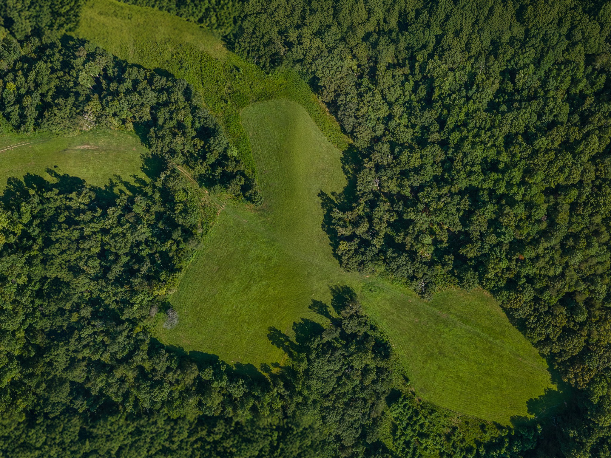
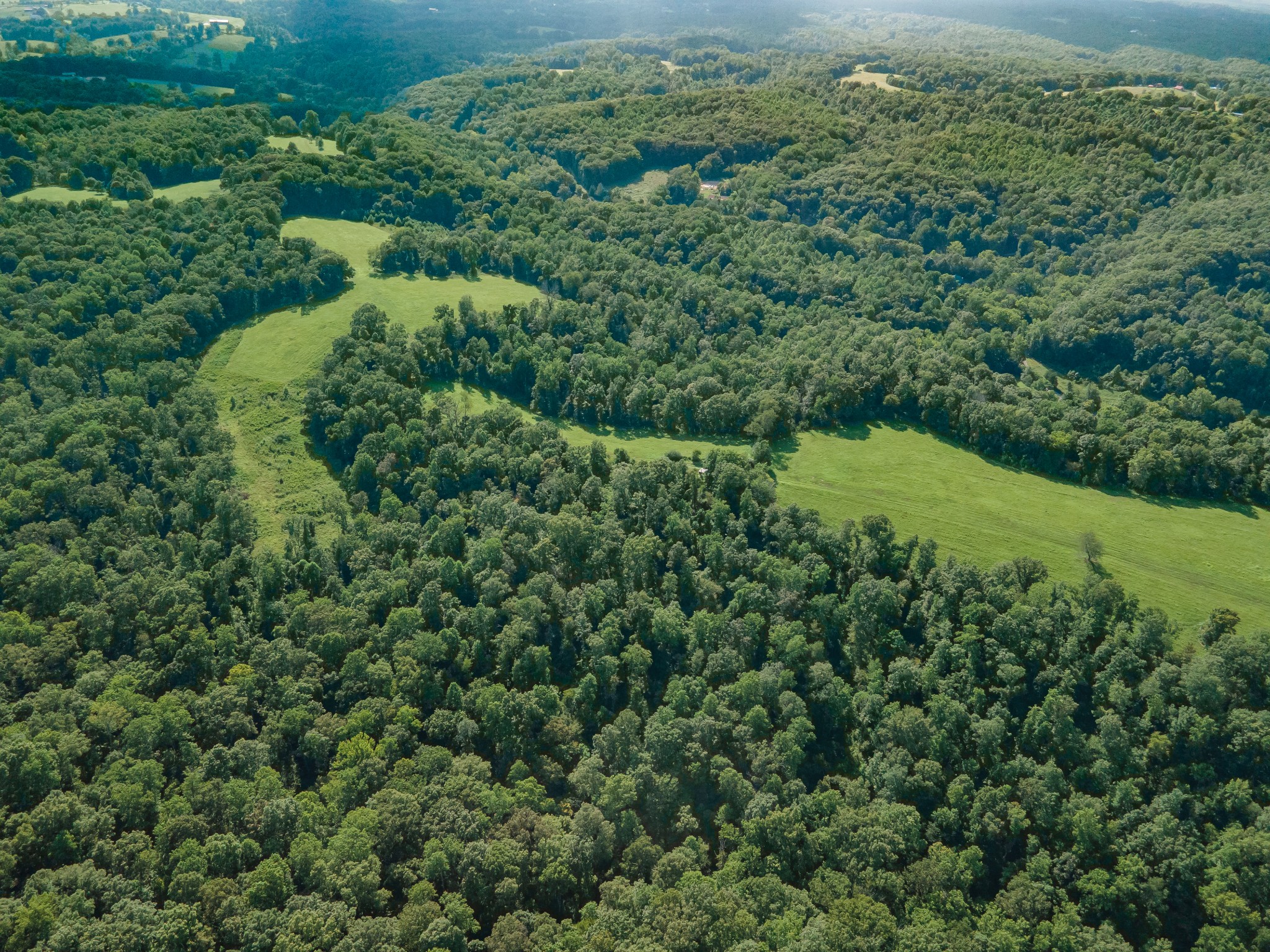
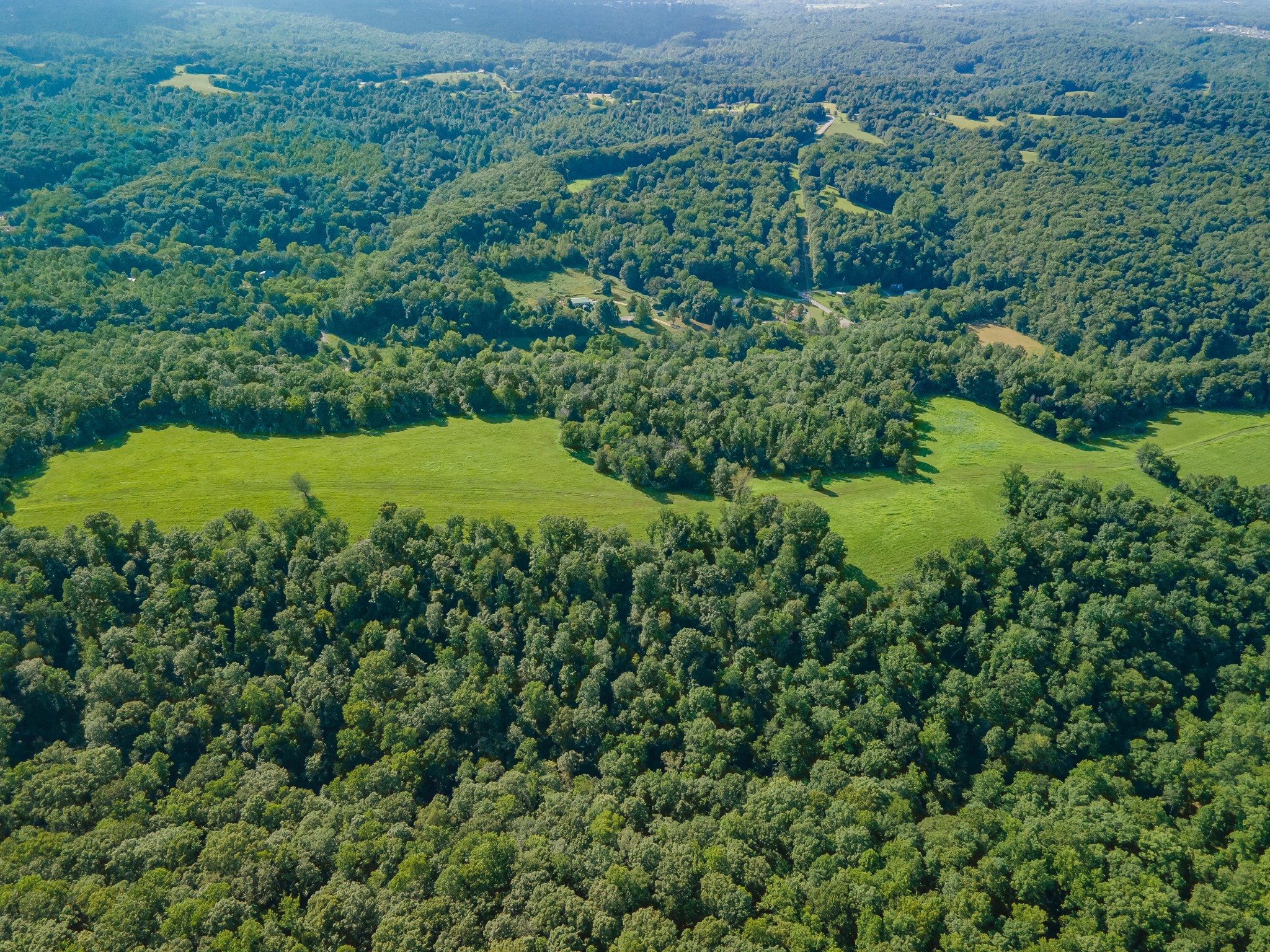
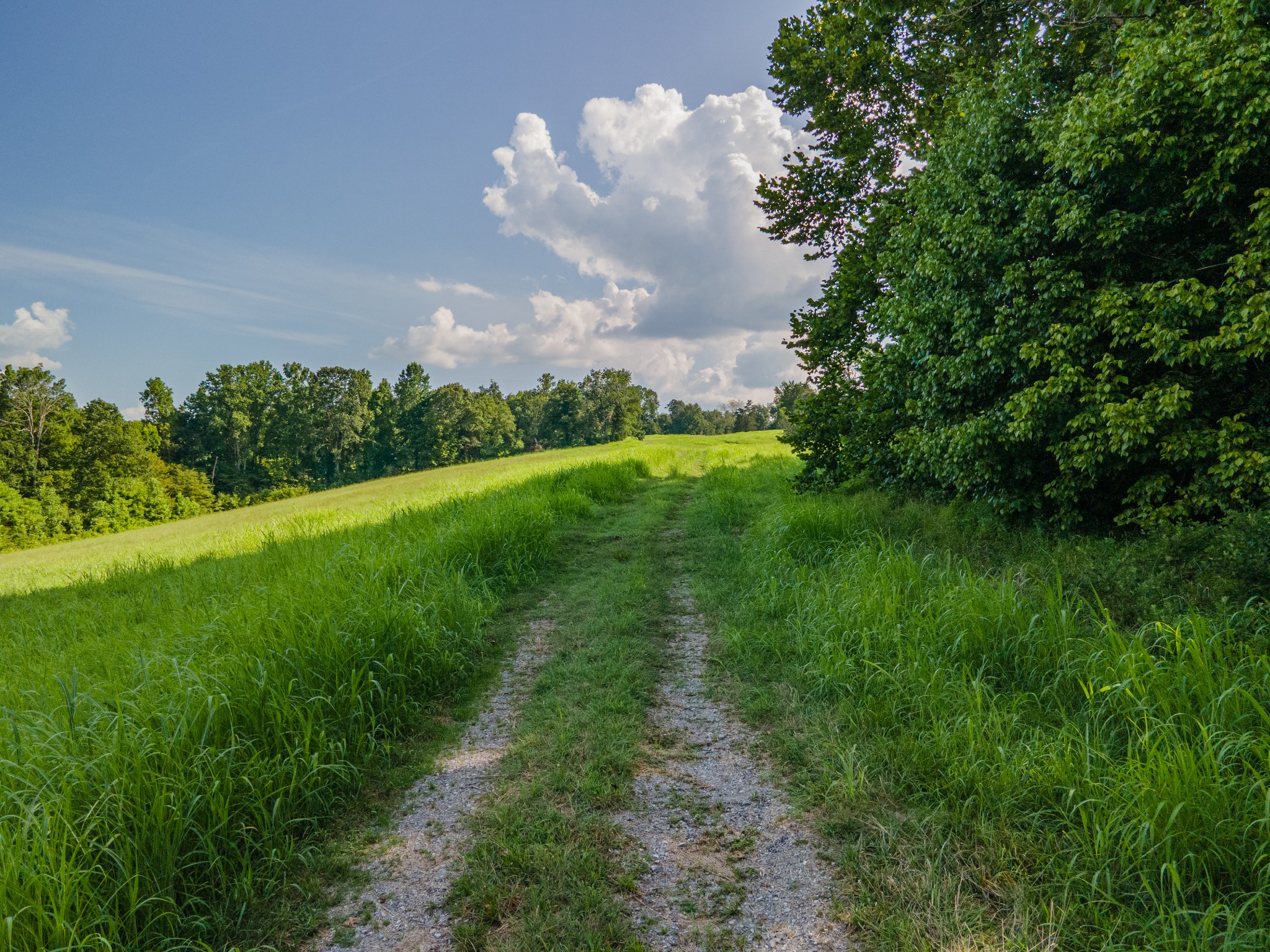
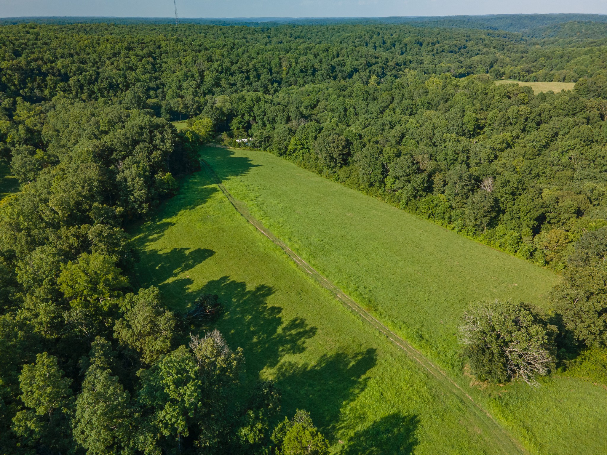
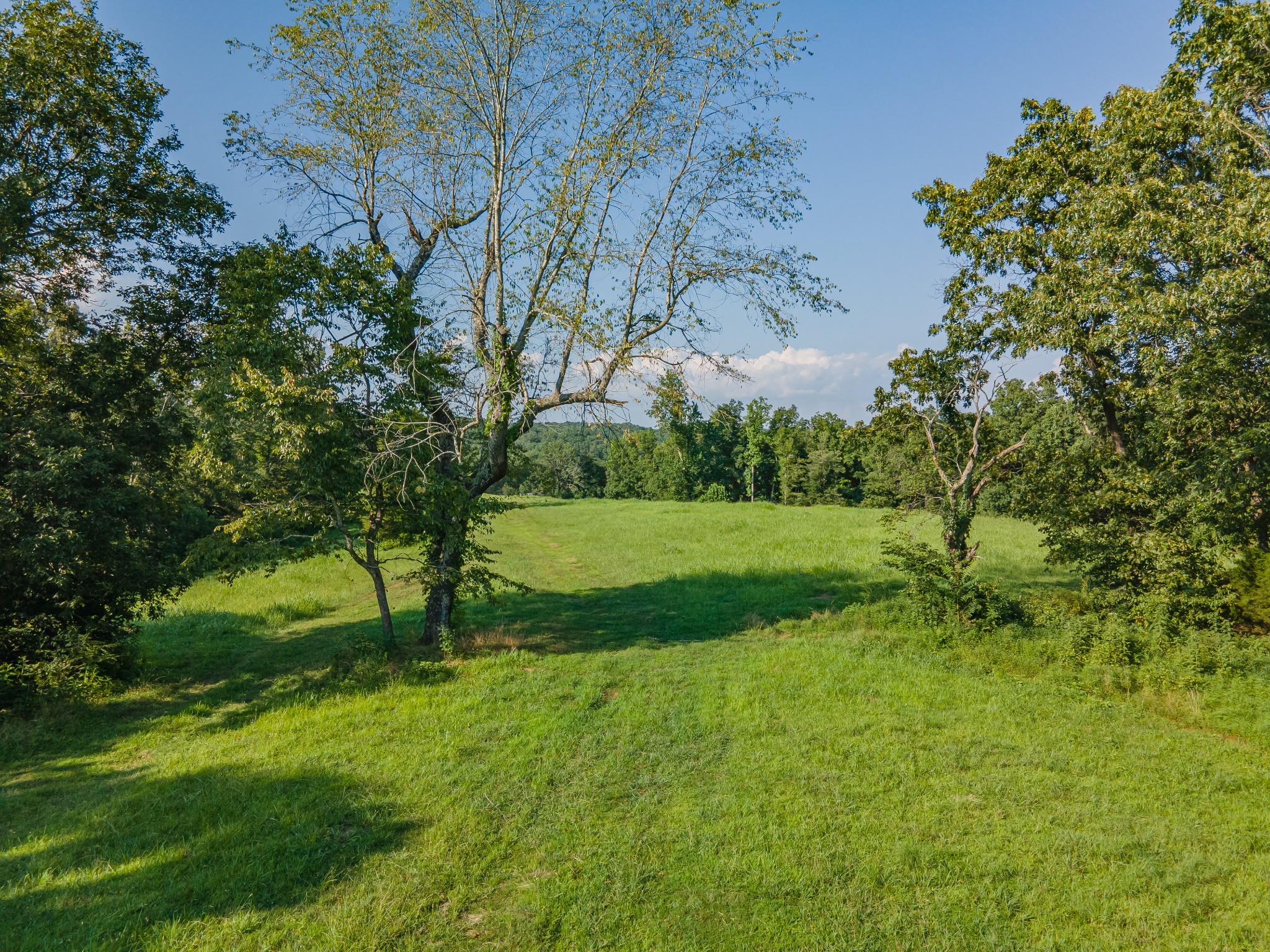
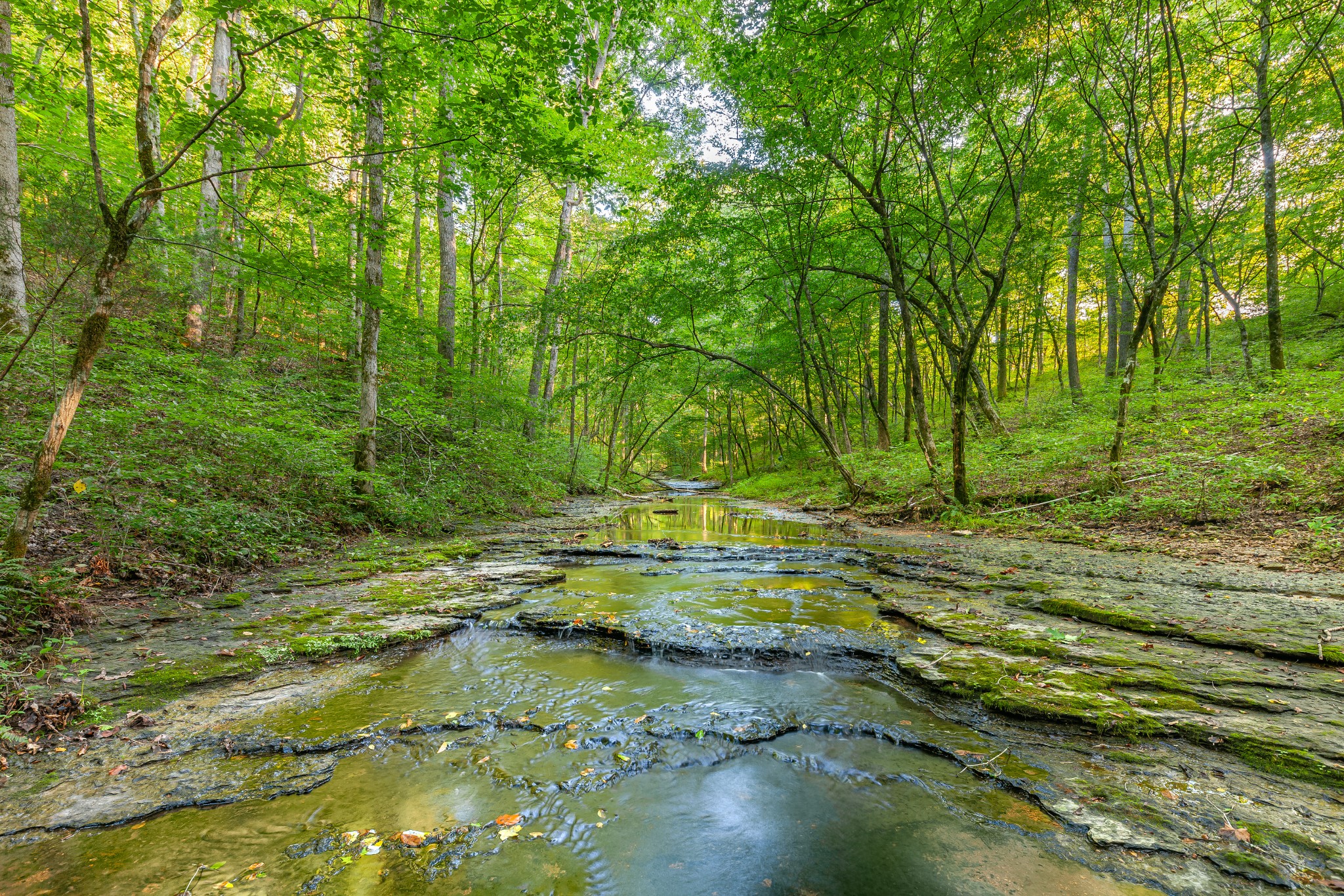
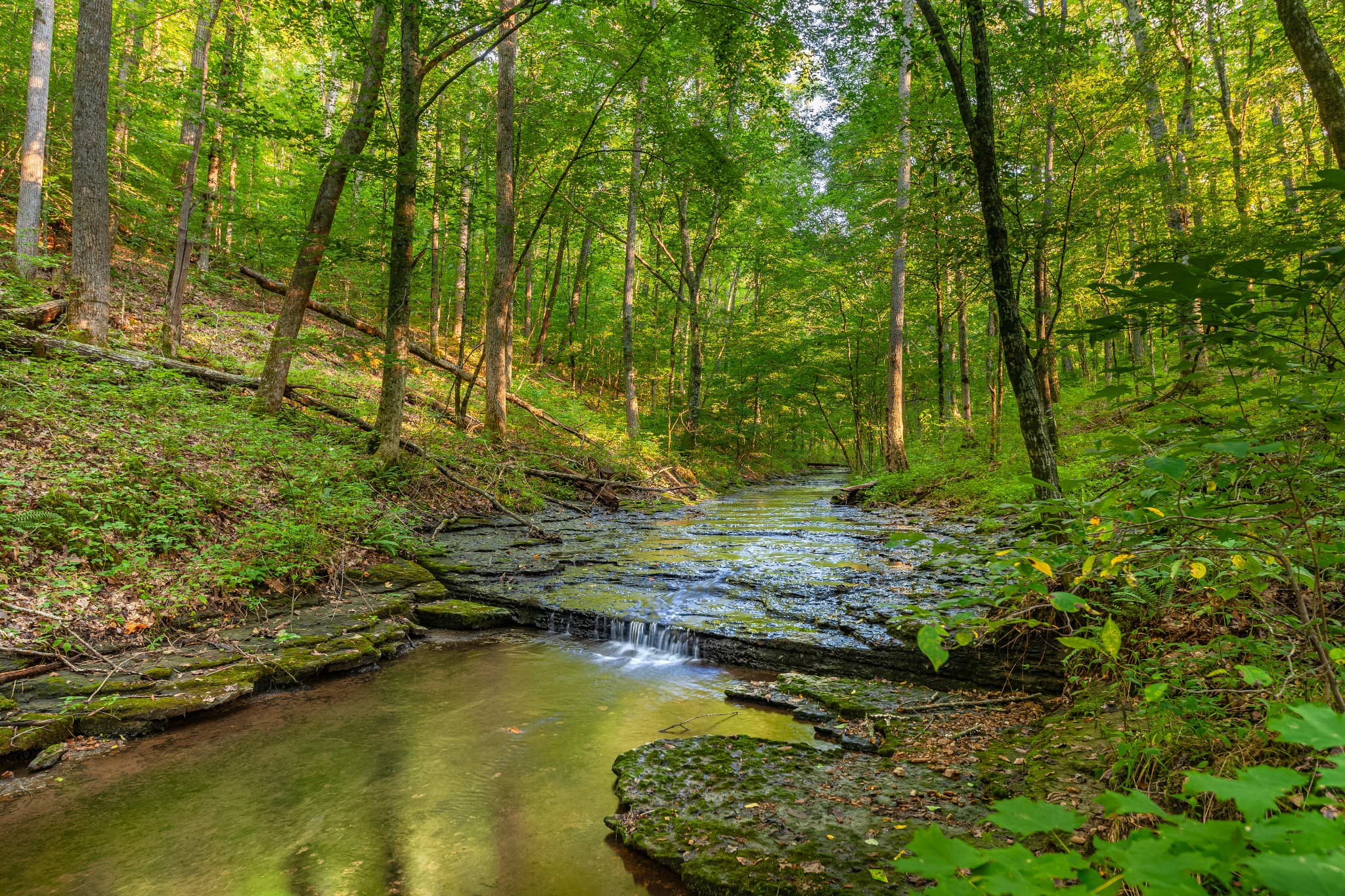
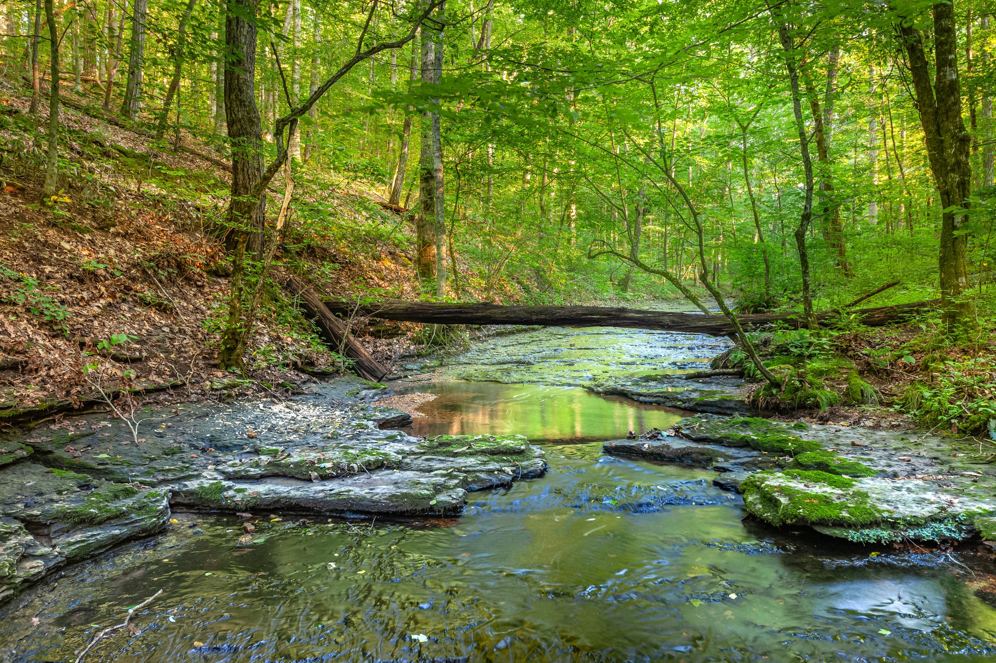
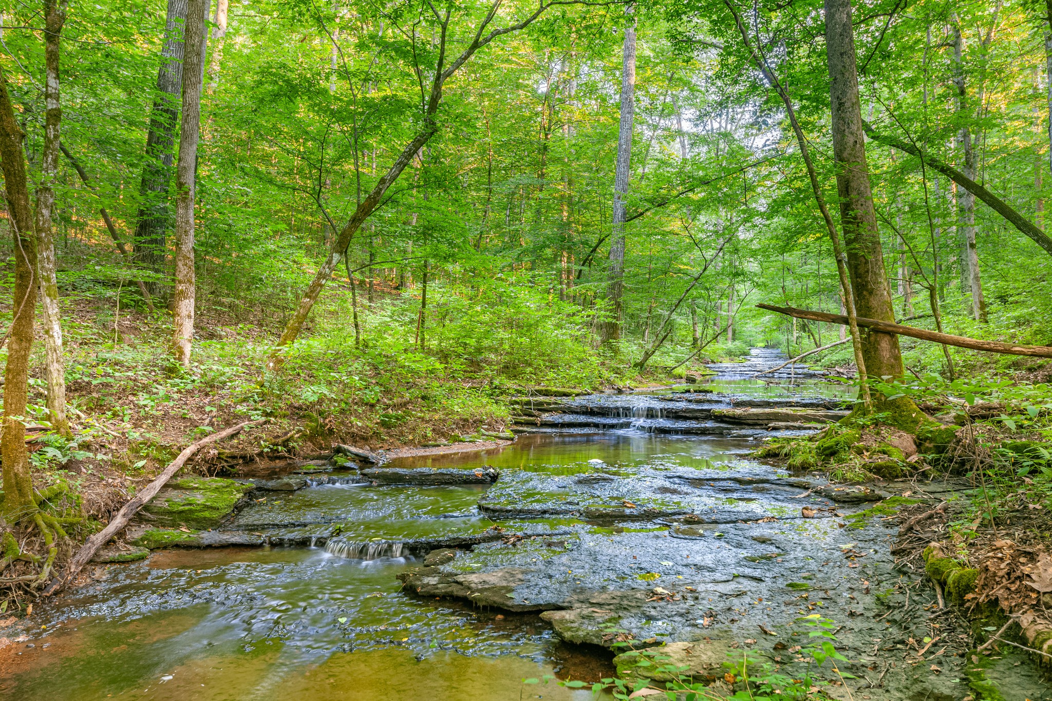
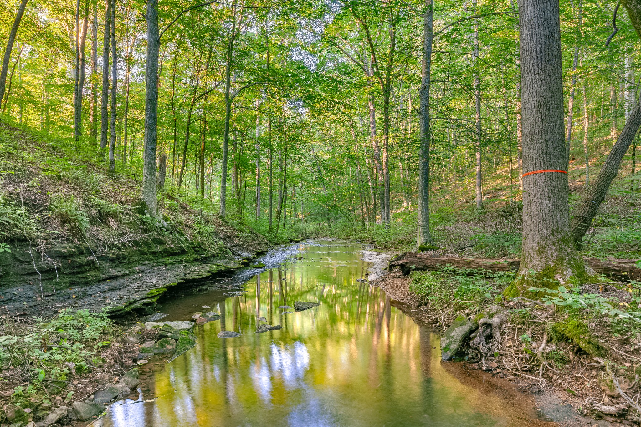
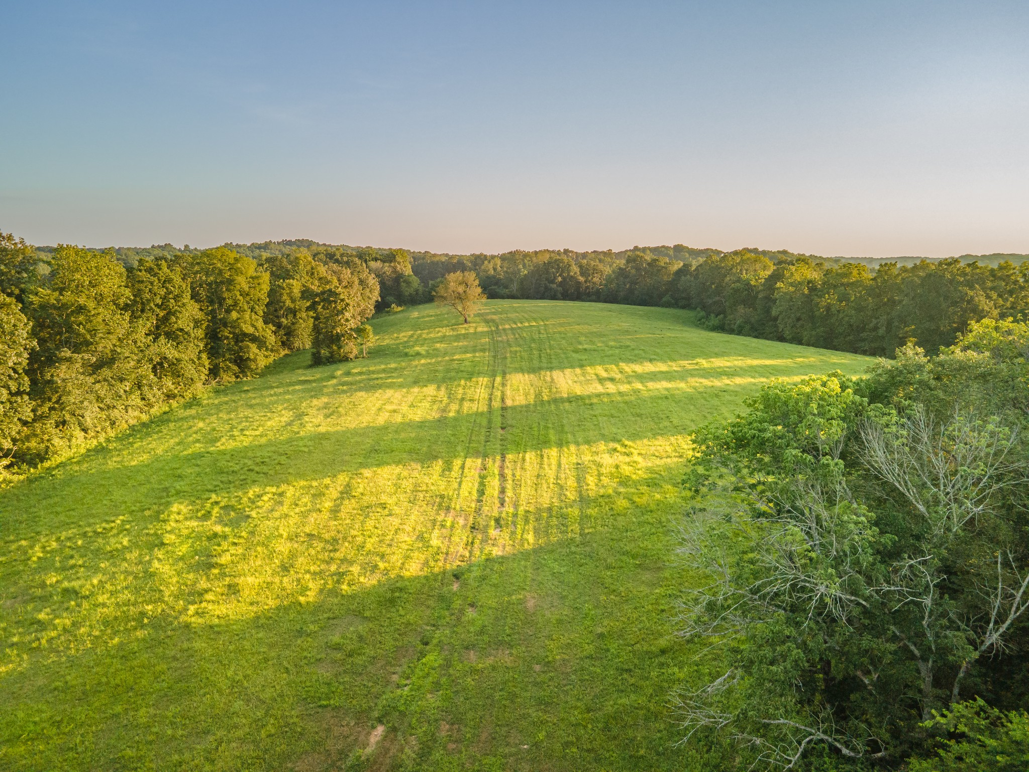
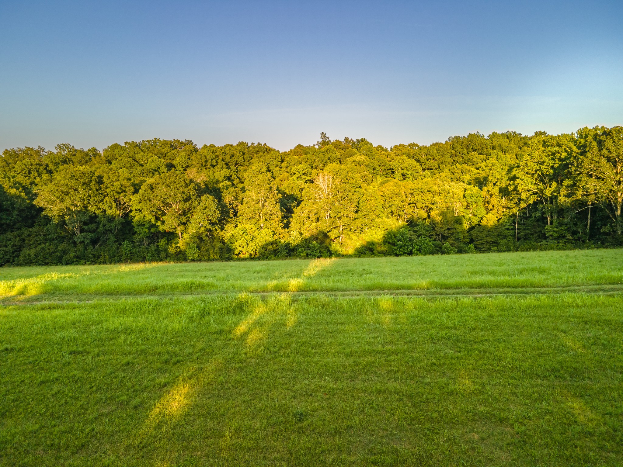
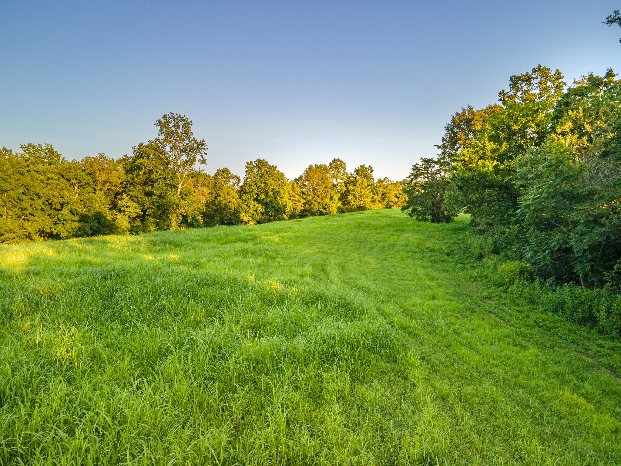
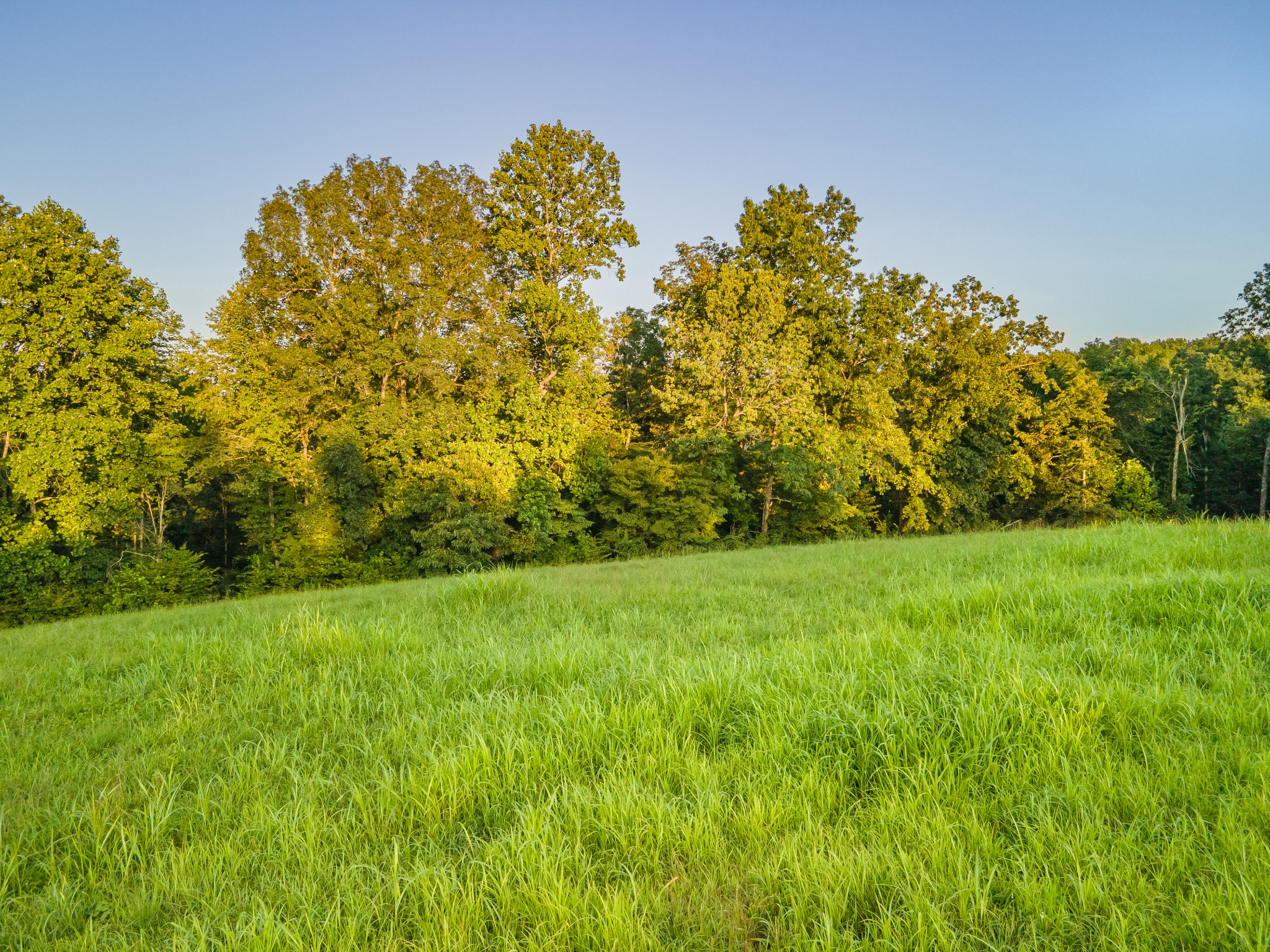
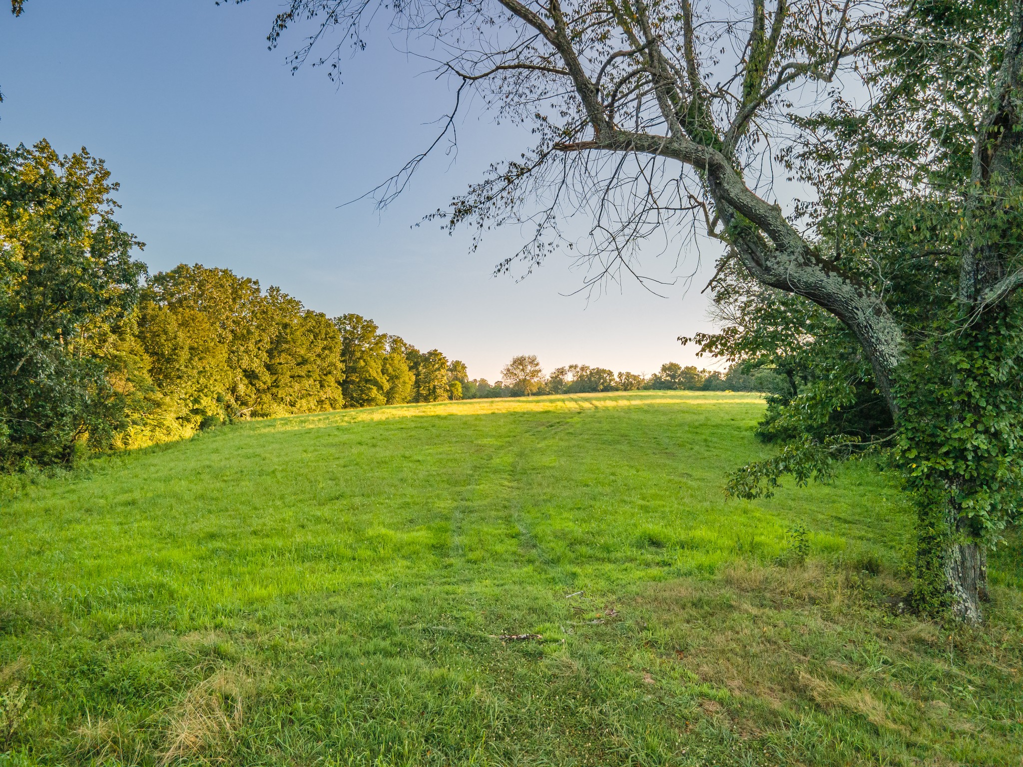
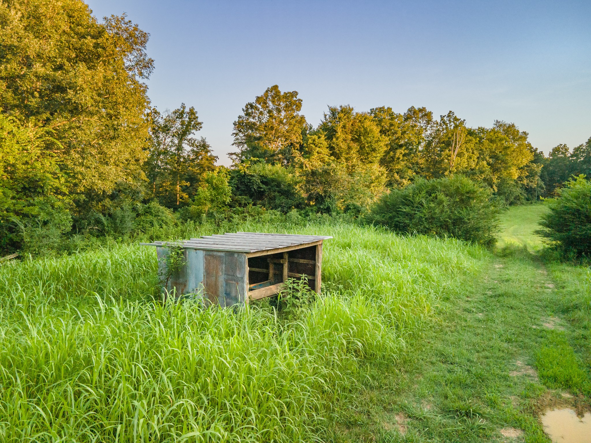
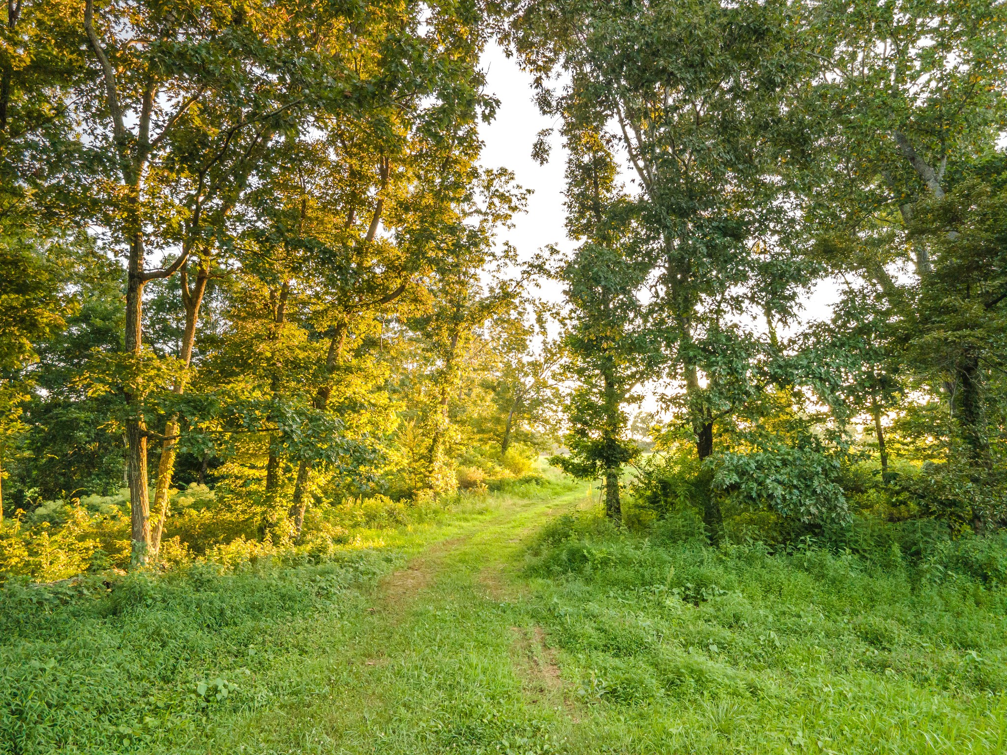
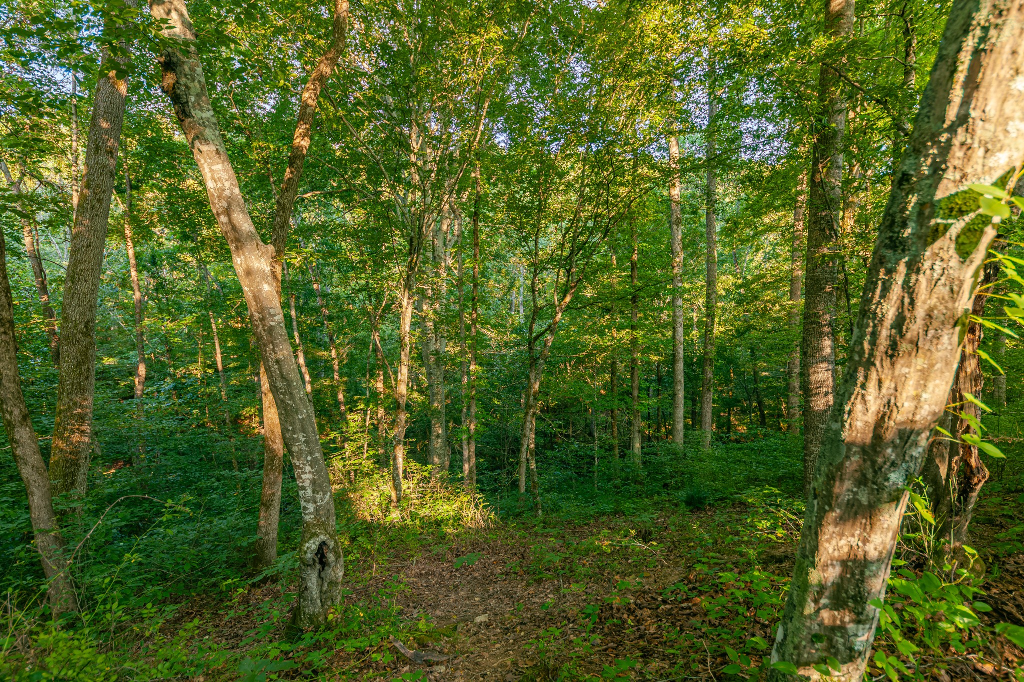
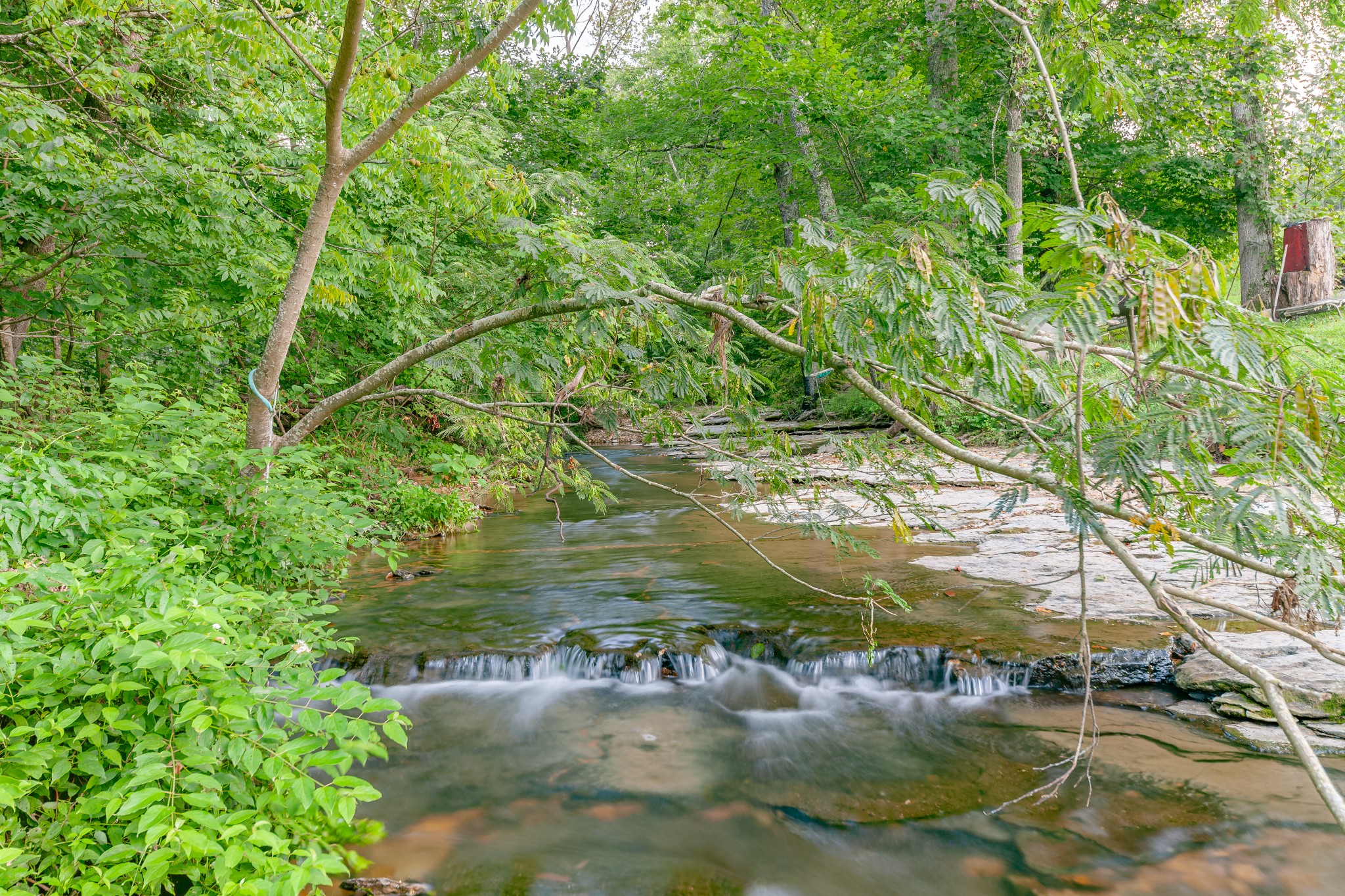
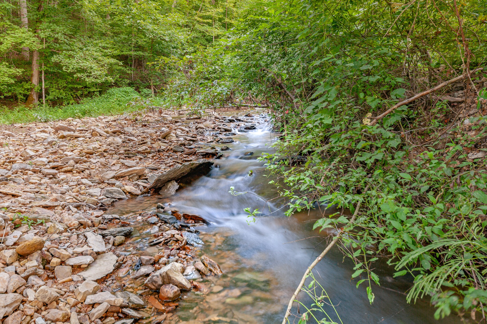
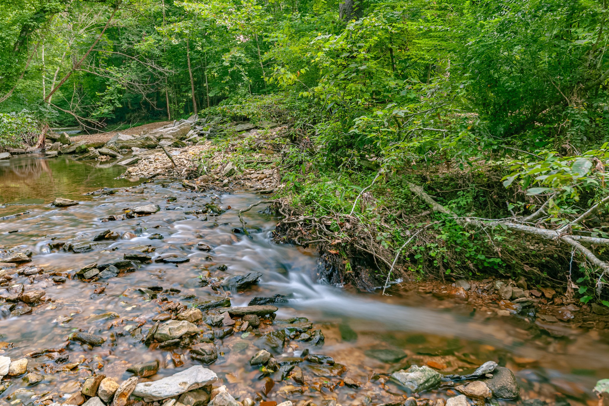
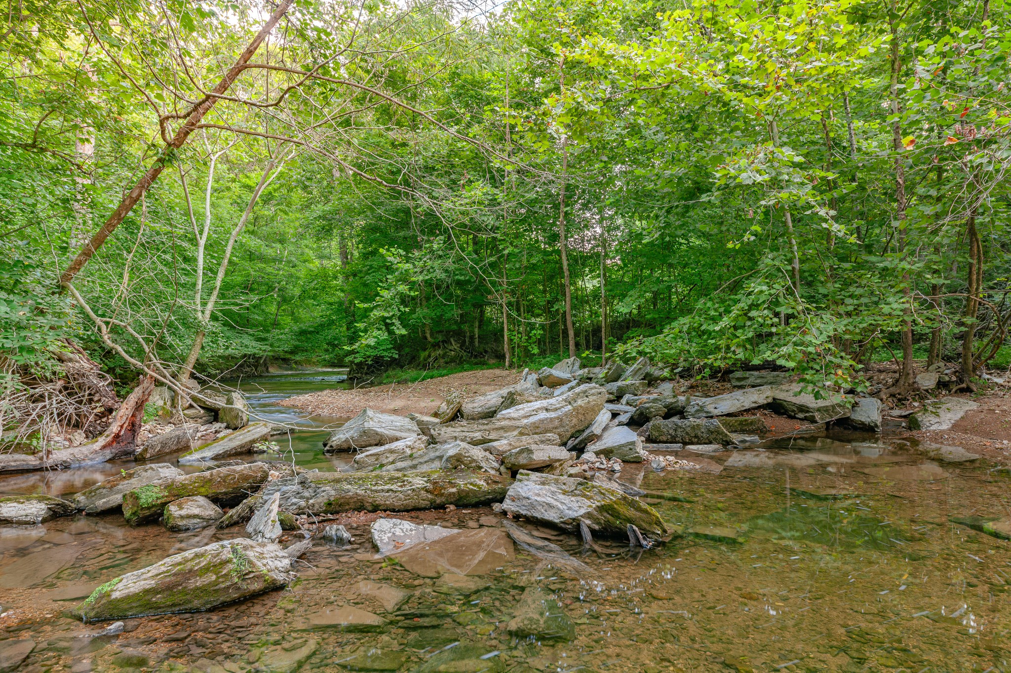
[description] => Hard to find large Williamson County land of 141.28 surveyed acres. Less than 10 miles from historic Leipers Fork. Farm has been in same family since the 1950/60's. Estimated 35-40+/- pasture acres. 100+ acres of mature trees including hardwoods. Potential for multiple build sites (county RP-5 area). Over 1,800 ft of S Harpeth Rd frontage. Plenty of room for horses & livestock. Creeks border both the east & west sides of the property. S Harpeth Creek on west for over 2,100 ft +/-, Coldwater Branch on east side for over 4,600 ft +/-. Possibility of using spring water from Coldwater Branch. Plentiful wildlife incl deer & turkey. Width of property varies from a few hundred yards to over 600 yards. Almost a mile from road to back property boundary. Power at the road. House on property has no value.
[location] => stdClass Object
(
[city] => Franklin
[state] => Tennessee
[postal_code] => 37064
[county] => Williamson County, TN
[street] => stdClass Object
(
[number] => 7393
[name] => S Harpeth Rd
[full] => 7393 S Harpeth Rd
)
[directions] => Starting in Leipers Fork take Old Hwy 96 from Hillsboro Rd. Go about 7 miles & turn left on S Harpeth Rd. Travel approx 2.2 miles to address. Land on left side of the road.
[coordinates] => stdClass Object
(
[latitude] => 35.920964
[longitude] => -87.11239
[geo_json] => stdClass Object
(
[type] => Point
[coordinates] => Array
(
[0] => -87.11239
[1] => 35.920964
)
)
)
)
[building] => stdClass Object
(
[fireplaces] => stdClass Object
(
[exists] =>
)
)
[surroundings] => stdClass Object
(
[land] => stdClass Object
(
[size] => stdClass Object
(
[acres] => 141.28
)
[description] => Array
(
[0] => Hilly
[1] => Level
[2] => Sloped
[3] => Wooded
)
)
[school] => stdClass Object
(
[elementary] => Fairview Elementary
[junior] => Fairview Middle School
[high] => Fairview High School
)
)
[last_updated] => stdClass Object
(
[$date] => 2025-08-29T12:39:00Z
)
[office] => stdClass Object
(
[name] => Mossy Oak Properties Clarksville, TN Land & Farm
[broker_id] => 4965
)
[agents] => Array
(
[0] => stdClass Object
(
[name] => stdClass Object
(
[first] => Dennis
[last] => Jolley
)
[phone] => stdClass Object
(
[preferred] => 6158120654
[mobile] => 6158120654
)
[agent_id] => 40094
)
)
[media] => stdClass Object
(
[photos] => Array
(
[0] => stdClass Object
(
[position] => 0
[description] => Property boundaries with creeks labeled
[urls] => stdClass Object
(
[original] => https://new.photos.idx.io/rt2/2945566/0.jpg
[215x] => https://new.photos.idx.io/rt2/2945566/0/215x.jpg
[440x] => https://new.photos.idx.io/rt2/2945566/0/440x.jpg
)
)
[1] => stdClass Object
(
[position] => 1
[description] => Property boundaries view from back of property
[urls] => stdClass Object
(
[original] => https://new.photos.idx.io/rt2/2945566/1.jpg
[215x] => https://new.photos.idx.io/rt2/2945566/1/215x.jpg
[440x] => https://new.photos.idx.io/rt2/2945566/1/440x.jpg
)
)
[2] => stdClass Object
(
[position] => 2
[urls] => stdClass Object
(
[original] => https://new.photos.idx.io/rt2/2945566/2.jpg
[215x] => https://new.photos.idx.io/rt2/2945566/2/215x.jpg
[440x] => https://new.photos.idx.io/rt2/2945566/2/440x.jpg
)
)
[3] => stdClass Object
(
[position] => 3
[urls] => stdClass Object
(
[original] => https://new.photos.idx.io/rt2/2945566/3.jpg
[215x] => https://new.photos.idx.io/rt2/2945566/3/215x.jpg
[440x] => https://new.photos.idx.io/rt2/2945566/3/440x.jpg
)
)
[4] => stdClass Object
(
[position] => 4
[urls] => stdClass Object
(
[original] => https://new.photos.idx.io/rt2/2945566/4.jpg
[215x] => https://new.photos.idx.io/rt2/2945566/4/215x.jpg
[440x] => https://new.photos.idx.io/rt2/2945566/4/440x.jpg
)
)
[5] => stdClass Object
(
[position] => 5
[urls] => stdClass Object
(
[original] => https://new.photos.idx.io/rt2/2945566/5.jpg
[215x] => https://new.photos.idx.io/rt2/2945566/5/215x.jpg
[440x] => https://new.photos.idx.io/rt2/2945566/5/440x.jpg
)
)
[6] => stdClass Object
(
[position] => 6
[urls] => stdClass Object
(
[original] => https://new.photos.idx.io/rt2/2945566/6.jpg
[215x] => https://new.photos.idx.io/rt2/2945566/6/215x.jpg
[440x] => https://new.photos.idx.io/rt2/2945566/6/440x.jpg
)
)
[7] => stdClass Object
(
[position] => 7
[urls] => stdClass Object
(
[original] => https://new.photos.idx.io/rt2/2945566/7.jpg
[215x] => https://new.photos.idx.io/rt2/2945566/7/215x.jpg
[440x] => https://new.photos.idx.io/rt2/2945566/7/440x.jpg
)
)
[8] => stdClass Object
(
[position] => 8
[urls] => stdClass Object
(
[original] => https://new.photos.idx.io/rt2/2945566/8.jpg
[215x] => https://new.photos.idx.io/rt2/2945566/8/215x.jpg
[440x] => https://new.photos.idx.io/rt2/2945566/8/440x.jpg
)
)
[9] => stdClass Object
(
[position] => 9
[urls] => stdClass Object
(
[original] => https://new.photos.idx.io/rt2/2945566/9.jpg
[215x] => https://new.photos.idx.io/rt2/2945566/9/215x.jpg
[440x] => https://new.photos.idx.io/rt2/2945566/9/440x.jpg
)
)
[10] => stdClass Object
(
[position] => 10
[urls] => stdClass Object
(
[original] => https://new.photos.idx.io/rt2/2945566/10.jpg
[215x] => https://new.photos.idx.io/rt2/2945566/10/215x.jpg
[440x] => https://new.photos.idx.io/rt2/2945566/10/440x.jpg
)
)
[11] => stdClass Object
(
[position] => 11
[urls] => stdClass Object
(
[original] => https://new.photos.idx.io/rt2/2945566/11.jpg
[215x] => https://new.photos.idx.io/rt2/2945566/11/215x.jpg
[440x] => https://new.photos.idx.io/rt2/2945566/11/440x.jpg
)
)
[12] => stdClass Object
(
[position] => 12
[description] => Coldwater Branch
[urls] => stdClass Object
(
[original] => https://new.photos.idx.io/rt2/2945566/12.jpg
[215x] => https://new.photos.idx.io/rt2/2945566/12/215x.jpg
[440x] => https://new.photos.idx.io/rt2/2945566/12/440x.jpg
)
)
[13] => stdClass Object
(
[position] => 13
[description] => Coldwater Branch
[urls] => stdClass Object
(
[original] => https://new.photos.idx.io/rt2/2945566/13.jpg
[215x] => https://new.photos.idx.io/rt2/2945566/13/215x.jpg
[440x] => https://new.photos.idx.io/rt2/2945566/13/440x.jpg
)
)
[14] => stdClass Object
(
[position] => 14
[description] => Coldwater Branch
[urls] => stdClass Object
(
[original] => https://new.photos.idx.io/rt2/2945566/14.jpg
[215x] => https://new.photos.idx.io/rt2/2945566/14/215x.jpg
[440x] => https://new.photos.idx.io/rt2/2945566/14/440x.jpg
)
)
[15] => stdClass Object
(
[position] => 15
[description] => Coldwater Branch
[urls] => stdClass Object
(
[original] => https://new.photos.idx.io/rt2/2945566/15.jpg
[215x] => https://new.photos.idx.io/rt2/2945566/15/215x.jpg
[440x] => https://new.photos.idx.io/rt2/2945566/15/440x.jpg
)
)
[16] => stdClass Object
(
[position] => 16
[description] => Coldwater Branch
[urls] => stdClass Object
(
[original] => https://new.photos.idx.io/rt2/2945566/16.jpg
[215x] => https://new.photos.idx.io/rt2/2945566/16/215x.jpg
[440x] => https://new.photos.idx.io/rt2/2945566/16/440x.jpg
)
)
[17] => stdClass Object
(
[position] => 17
[description] => Coldwater Branch
[urls] => stdClass Object
(
[original] => https://new.photos.idx.io/rt2/2945566/17.jpg
[215x] => https://new.photos.idx.io/rt2/2945566/17/215x.jpg
[440x] => https://new.photos.idx.io/rt2/2945566/17/440x.jpg
)
)
[18] => stdClass Object
(
[position] => 18
[description] => Aerial View
[urls] => stdClass Object
(
[original] => https://new.photos.idx.io/rt2/2945566/18.jpg
[215x] => https://new.photos.idx.io/rt2/2945566/18/215x.jpg
[440x] => https://new.photos.idx.io/rt2/2945566/18/440x.jpg
)
)
[19] => stdClass Object
(
[position] => 19
[description] => Sunlit Field
[urls] => stdClass Object
(
[original] => https://new.photos.idx.io/rt2/2945566/19.jpg
[215x] => https://new.photos.idx.io/rt2/2945566/19/215x.jpg
[440x] => https://new.photos.idx.io/rt2/2945566/19/440x.jpg
)
)
[20] => stdClass Object
(
[position] => 20
[description] => Sunlit Field
[urls] => stdClass Object
(
[original] => https://new.photos.idx.io/rt2/2945566/20.jpg
[215x] => https://new.photos.idx.io/rt2/2945566/20/215x.jpg
[440x] => https://new.photos.idx.io/rt2/2945566/20/440x.jpg
)
)
[21] => stdClass Object
(
[position] => 21
[description] => Sunlit Field and Trees
[urls] => stdClass Object
(
[original] => https://new.photos.idx.io/rt2/2945566/21.jpg
[215x] => https://new.photos.idx.io/rt2/2945566/21/215x.jpg
[440x] => https://new.photos.idx.io/rt2/2945566/21/440x.jpg
)
)
[22] => stdClass Object
(
[position] => 22
[description] => Sunlit View of Pasture
[urls] => stdClass Object
(
[original] => https://new.photos.idx.io/rt2/2945566/22.jpg
[215x] => https://new.photos.idx.io/rt2/2945566/22/215x.jpg
[440x] => https://new.photos.idx.io/rt2/2945566/22/440x.jpg
)
)
[23] => stdClass Object
(
[position] => 23
[description] => Old Shed
[urls] => stdClass Object
(
[original] => https://new.photos.idx.io/rt2/2945566/23.jpg
[215x] => https://new.photos.idx.io/rt2/2945566/23/215x.jpg
[440x] => https://new.photos.idx.io/rt2/2945566/23/440x.jpg
)
)
[24] => stdClass Object
(
[position] => 24
[description] => Gravel Road
[urls] => stdClass Object
(
[original] => https://new.photos.idx.io/rt2/2945566/24.jpg
[215x] => https://new.photos.idx.io/rt2/2945566/24/215x.jpg
[440x] => https://new.photos.idx.io/rt2/2945566/24/440x.jpg
)
)
[25] => stdClass Object
(
[position] => 25
[description] => View into the Woods
[urls] => stdClass Object
(
[original] => https://new.photos.idx.io/rt2/2945566/25.jpg
[215x] => https://new.photos.idx.io/rt2/2945566/25/215x.jpg
[440x] => https://new.photos.idx.io/rt2/2945566/25/440x.jpg
)
)
[26] => stdClass Object
(
[position] => 26
[description] => South Harpeth Creek
[urls] => stdClass Object
(
[original] => https://new.photos.idx.io/rt2/2945566/26.jpg
[215x] => https://new.photos.idx.io/rt2/2945566/26/215x.jpg
[440x] => https://new.photos.idx.io/rt2/2945566/26/440x.jpg
)
)
[27] => stdClass Object
(
[position] => 27
[description] => South Harpeth Creek
[urls] => stdClass Object
(
[original] => https://new.photos.idx.io/rt2/2945566/27.jpg
[215x] => https://new.photos.idx.io/rt2/2945566/27/215x.jpg
[440x] => https://new.photos.idx.io/rt2/2945566/27/440x.jpg
)
)
[28] => stdClass Object
(
[position] => 28
[description] => South Harpeth Creek
[urls] => stdClass Object
(
[original] => https://new.photos.idx.io/rt2/2945566/28.jpg
[215x] => https://new.photos.idx.io/rt2/2945566/28/215x.jpg
[440x] => https://new.photos.idx.io/rt2/2945566/28/440x.jpg
)
)
[29] => stdClass Object
(
[position] => 29
[description] => South Harpeth Creek
[urls] => stdClass Object
(
[original] => https://new.photos.idx.io/rt2/2945566/29.jpg
[215x] => https://new.photos.idx.io/rt2/2945566/29/215x.jpg
[440x] => https://new.photos.idx.io/rt2/2945566/29/440x.jpg
)
)
)
)
[key] => rt-2945566
[added_at] => stdClass Object
(
[$date] => 2025-07-30T22:11:00Z
)
[source] => rt
[self_link] => https://api.idx.io/listings/rt-2945566
)


- Lot DescriptionHilly, Level, Sloped, Wooded
- Acres141.28