stdClass Object
(
[type] => Land & Farm
[status] => stdClass Object
(
[current] => Pending
[last] => Active
[changed] => 2025-07-23T19:06:00
)
[ml_number] => 2942163
[price] => stdClass Object
(
[amount] => 395000
[original] => 395000
[last_changed_on] => 2025-07-17T01:02:03
)
[listing_flags] => Array
(
[0] => Financing
)
[available_on] => stdClass Object
(
[$date] => 2025-07-17T04:00:00Z
)
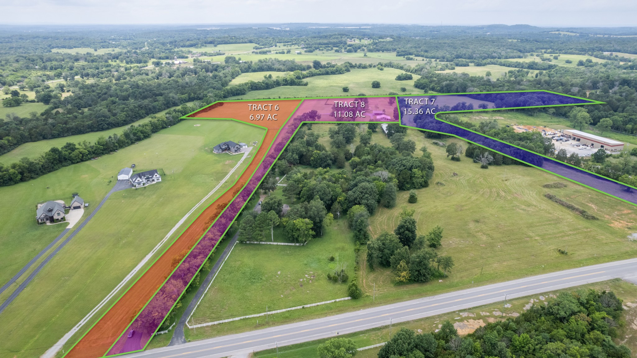
[description] => 15.36 acres+/- shaded purple in above photo*4 BR soils site* beautiful level to rolling land*mostly pastureland + wooded area*small 2-stall horse shelter located in wooded area*MOWED TRAILS MEANDERING THROUGH WOODS*WOULD MAKE A FANTASTIC HORSE PROPERTY AND/OR A GREAT FAMILY COMPOUND AS 2 tracts left of subject tract are also available which is a large home on 11.08 acres(MLS 2942161) and another tract 6.97 ac (MLS 2942158) with approved 4 BR soils site*3 tracts selling separately but can be bought at same time. Taxes will need to be assessed on this tract-currently they are included with adjoining tract. Please MAKE APPOINTMENT through Realtracs before viewing land.
[location] => stdClass Object
(
[city] => Lebanon
[state] => Tennessee
[postal_code] => 37090
[county] => Wilson County, TN
[subdivision] => McCoy
[street] => stdClass Object
(
[number] => 3900
[name] => MURFREESBORO RD
[full] => 3900 MURFREESBORO RD
)
[directions] => From Nashville, I-40 E to Exit 238* R off ramp onto S. Cumberland St (Hwy 231S)* go 5.2 miles. See "1st" black and gold sign on right.
[coordinates] => stdClass Object
(
[latitude] => 36.110025
[longitude] => -86.329772
[geo_json] => stdClass Object
(
[type] => Point
[coordinates] => Array
(
[0] => -86.329772
[1] => 36.110025
)
)
)
)
[building] => stdClass Object
(
[square_feet] => stdClass Object
(
[size] => 0
)
[fireplaces] => stdClass Object
(
[exists] =>
)
)
[surroundings] => stdClass Object
(
[sewer] => Array
(
[0] => None
)
[land] => stdClass Object
(
[size] => stdClass Object
(
[acres] => 15.36
)
[description] => Array
(
[0] => Cleared
[1] => Level
[2] => Private
[3] => Rolling Slope
[4] => Wooded
)
)
[school] => stdClass Object
(
[elementary] => Southside Elementary
[junior] => Southside Elementary
[high] => Wilson Central High School
)
)
[last_updated] => stdClass Object
(
[$date] => 2025-07-23T23:06:00Z
)
[office] => stdClass Object
(
[name] => Agee & Johnson Realty & Auction, Inc
[broker_id] => 39
)
[agents] => Array
(
[0] => stdClass Object
(
[name] => stdClass Object
(
[first] => Lou Anne
[last] => Snyder
)
[phone] => stdClass Object
(
[preferred] => 6158044781
[mobile] => 6158044781
)
[agent_id] => 110
)
[1] => stdClass Object
(
[name] => stdClass Object
(
[first] => Ed
[last] => James
)
[phone] => stdClass Object
(
[preferred] => 6158046923
[mobile] => 6158046923
)
[agent_id] => 120
)
)
[media] => stdClass Object
(
[photos] => Array
(
[0] => stdClass Object
(
[position] => 0
[description] => Purple area of above diagram is tract 7----15.36 acres per survey. 51 ft of road frontage on Hwy 231.
[urls] => stdClass Object
(
[original] => https://new.photos.idx.io/rt2/2942163/0.jpg
[215x] => https://new.photos.idx.io/rt2/2942163/0/215x.jpg
[440x] => https://new.photos.idx.io/rt2/2942163/0/440x.jpg
)
)
[1] => stdClass Object
(
[position] => 1
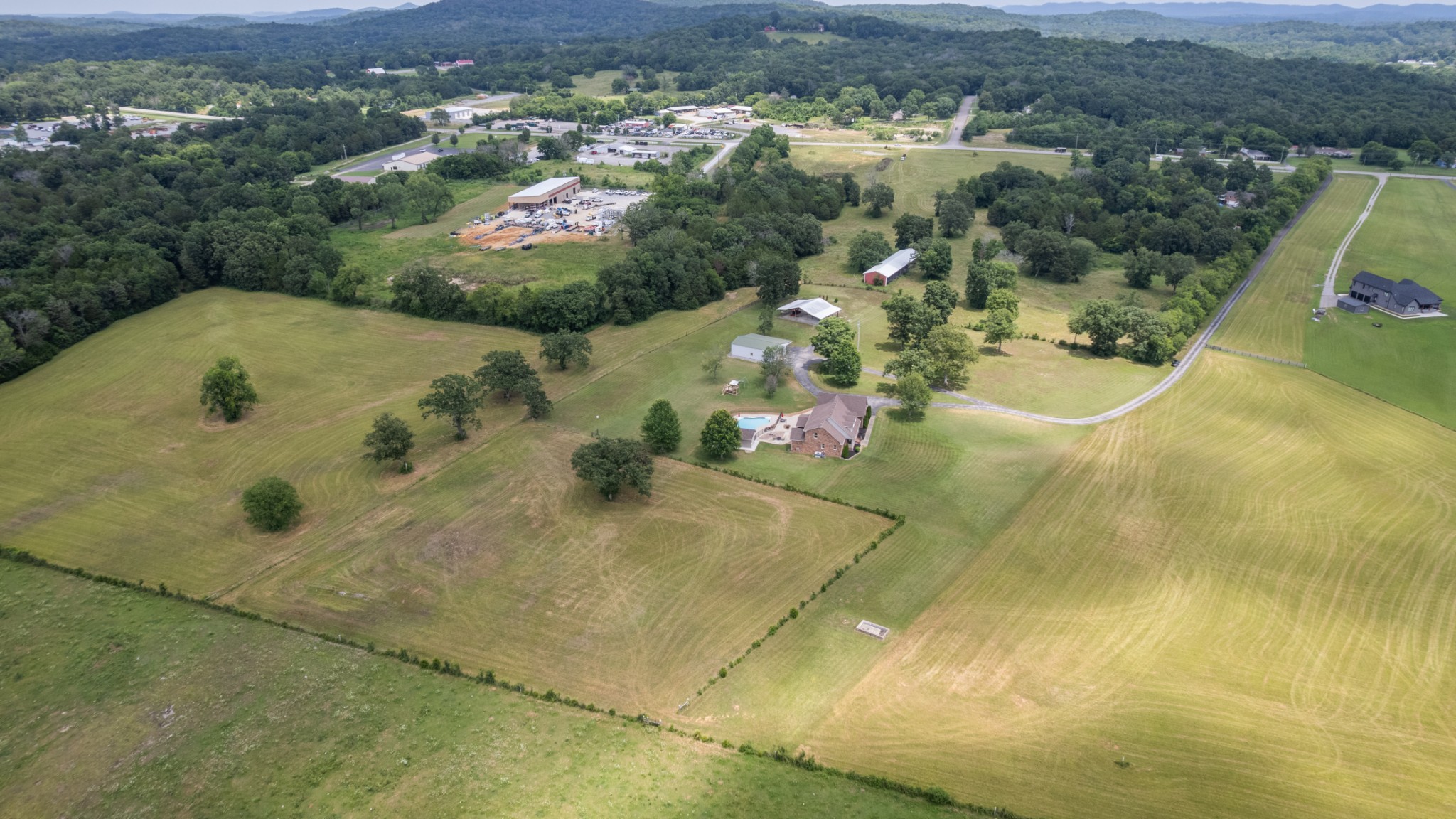
[description] => Rear portion of this photo shows tract 7--15.36 acres
[urls] => stdClass Object
(
[original] => https://new.photos.idx.io/rt2/2942163/1.jpg
[215x] => https://new.photos.idx.io/rt2/2942163/1/215x.jpg
[440x] => https://new.photos.idx.io/rt2/2942163/1/440x.jpg
)
)
[2] => stdClass Object
(
[position] => 2
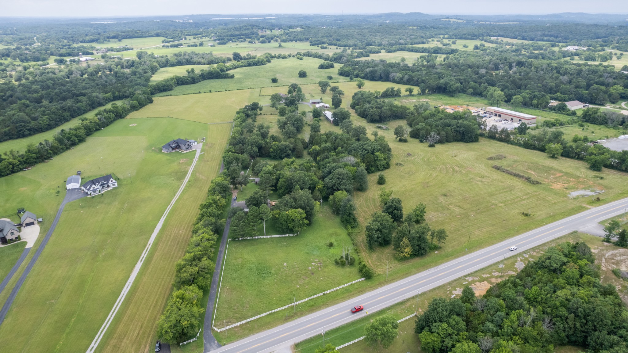
[description] => Rear portion is tract 7
[urls] => stdClass Object
(
[original] => https://new.photos.idx.io/rt2/2942163/2.jpg
[215x] => https://new.photos.idx.io/rt2/2942163/2/215x.jpg
[440x] => https://new.photos.idx.io/rt2/2942163/2/440x.jpg
)
)
[3] => stdClass Object
(
[position] => 3
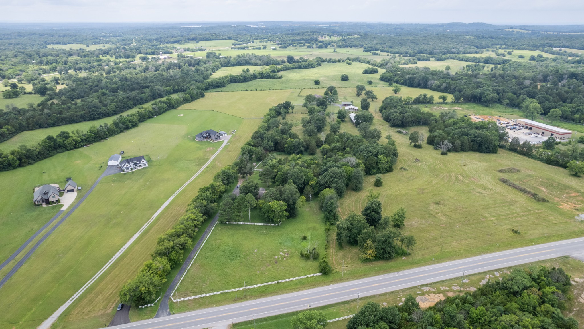
[description] => See survey plat for actual lines in media.
[urls] => stdClass Object
(
[original] => https://new.photos.idx.io/rt2/2942163/3.jpg
[215x] => https://new.photos.idx.io/rt2/2942163/3/215x.jpg
[440x] => https://new.photos.idx.io/rt2/2942163/3/440x.jpg
)
)
[4] => stdClass Object
(
[position] => 4
[urls] => stdClass Object
(
[original] => https://new.photos.idx.io/rt2/2942163/4.jpg
[215x] => https://new.photos.idx.io/rt2/2942163/4/215x.jpg
[440x] => https://new.photos.idx.io/rt2/2942163/4/440x.jpg
)
)
)
)
[selling_agents] => Array
(
[0] => stdClass Object
(
[name] => stdClass Object
(
[first] => Garon
[last] => Morris
)
[phone] => stdClass Object
(
[preferred] => 6159994711
[mobile] => 6159994711
)
)
)
[key] => rt-2942163
[added_at] => stdClass Object
(
[$date] => 2025-07-17T05:02:03Z
)
[source] => rt
[self_link] => https://api.idx.io/listings/rt-2942163
)
Exterior Details
SewerNone
Lot DescriptionCleared, Level, Private, Rolling Slope, Wooded
Acres15.36
$395,000
3900 MURFREESBORO RD
Lebanon,
Tennessee37090
0sq. ft.
15.36 acres+/- shaded purple in above photo*4 BR soils site* beautiful level to rolling land*mostly pastureland + wooded area*small 2-stall horse shelter located in wooded area*MOWED TRAILS MEANDERING THROUGH WOODS*WOULD MAKE A FANTASTIC HORSE PROPERTY AND/OR A GREAT FAMILY COMPOUND AS 2 tracts left of subject tract are also available which is a large home on 11.08 acres(MLS 2942161) and another tract 6.97 ac (MLS 2942158) with approved 4 BR soils site*3 tracts selling separately but can be bought at same time. Taxes will need to be assessed on this tract-currently they are included with adjoining tract. Please MAKE APPOINTMENT through Realtracs before viewing land.