Price - High to Low Price - Low to High Date Listed - New to Old Date Listed - Old to New
stdClass Object
(
[type] => Land
[status] => stdClass Object
(
[current] => Active
[last] => Active
[changed] => 2025-07-07T10:54:00
)
[ml_number] => 2629025
[price] => stdClass Object
(
[amount] => 1694900
[original] => 1694900
[last_changed_on] => 2025-07-07T10:54:00
)
[available_on] => stdClass Object
(
[$date] => 2024-03-12T04:00:00Z
)
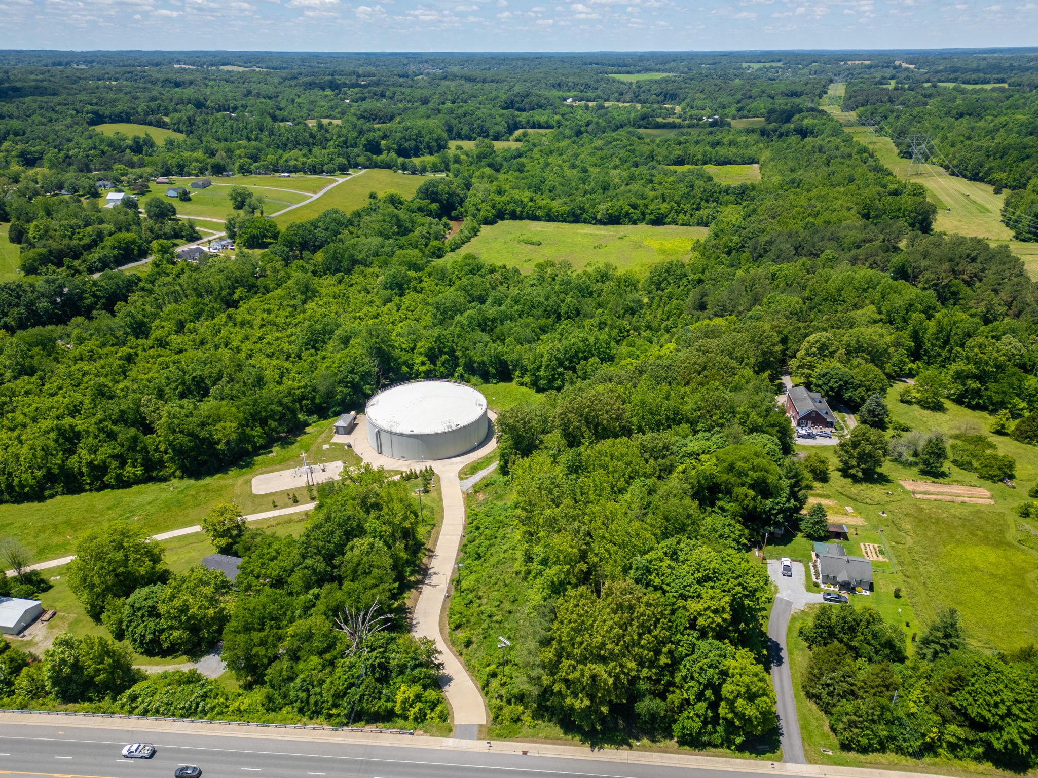
[description] => Large acreage tract in area of Prime development in Springfield! Currently zoned agricultural in Greenbelt tax program - will be buyers responsibility to re enroll in to tax program or pay rollback taxes. 12" and 24" city sewer lines run through property with 2 entries for access. Develop as you please!!!
[location] => stdClass Object
(
[city] => Springfield
[state] => Tennessee
[postal_code] => 37172
[county] => Robertson County, TN
[street] => stdClass Object
(
[number] => 70
[name] => R A Benton Ln
[full] => 70 R A Benton Ln
)
[directions] => From NASHVILLE I24 to EXIT 35 to RIGHT on HWY 431 toward SPRINGFIELD - Property will be on LEFT past WILLIAM A BATSON BLVD - across fom S MAIN STREET to BENTON LANE
[coordinates] => stdClass Object
(
[latitude] => 36.472454
[longitude] => -86.894043
[geo_json] => stdClass Object
(
[type] => Point
[coordinates] => Array
(
[0] => -86.894043
[1] => 36.472454
)
)
)
)
[building] => stdClass Object
(
[fireplaces] => stdClass Object
(
[exists] =>
)
)
[surroundings] => stdClass Object
(
[sewer] => Array
(
[0] => None
)
[land] => stdClass Object
(
[size] => stdClass Object
(
[dimensions] => 73.7
[acres] => 73.7
)
[description] => Array
(
[0] => Rolling Slope
[1] => Wooded
)
)
[school] => stdClass Object
(
[elementary] => Coopertown Elementary
[junior] => Coopertown Middle School
[high] => Springfield High School
)
)
[last_updated] => stdClass Object
(
[$date] => 2025-07-07T14:54:00Z
)
[office] => stdClass Object
(
[name] => RE/MAX 1ST Choice
[broker_id] => 1179
)
[agents] => Array
(
[0] => stdClass Object
(
[name] => stdClass Object
(
[first] => Jackie
[middle] => D
[last] => Adams
)
[phone] => stdClass Object
(
[preferred] => 6157082501
[mobile] => 6157082501
[fax] => 6153847366
)
[agent_id] => 8795
)
)
[media] => stdClass Object
(
[photos] => Array
(
[0] => stdClass Object
(
[position] => 0
[urls] => stdClass Object
(
[original] => https://new.photos.idx.io/rt2/2629025/0.jpg
[215x] => https://new.photos.idx.io/rt2/2629025/0/215x.jpg
[440x] => https://new.photos.idx.io/rt2/2629025/0/440x.jpg
)
)
[1] => stdClass Object
(
[position] => 1
[urls] => stdClass Object
(
[original] => https://new.photos.idx.io/rt2/2629025/1.jpg
[215x] => https://new.photos.idx.io/rt2/2629025/1/215x.jpg
[440x] => https://new.photos.idx.io/rt2/2629025/1/440x.jpg
)
)
[2] => stdClass Object
(
[position] => 2
[urls] => stdClass Object
(
[original] => https://new.photos.idx.io/rt2/2629025/2.jpg
[215x] => https://new.photos.idx.io/rt2/2629025/2/215x.jpg
[440x] => https://new.photos.idx.io/rt2/2629025/2/440x.jpg
)
)
[3] => stdClass Object
(
[position] => 3
[urls] => stdClass Object
(
[original] => https://new.photos.idx.io/rt2/2629025/3.jpg
[215x] => https://new.photos.idx.io/rt2/2629025/3/215x.jpg
[440x] => https://new.photos.idx.io/rt2/2629025/3/440x.jpg
)
)
[4] => stdClass Object
(
[position] => 4
[urls] => stdClass Object
(
[original] => https://new.photos.idx.io/rt2/2629025/4.jpg
[215x] => https://new.photos.idx.io/rt2/2629025/4/215x.jpg
[440x] => https://new.photos.idx.io/rt2/2629025/4/440x.jpg
)
)
[5] => stdClass Object
(
[position] => 5
[urls] => stdClass Object
(
[original] => https://new.photos.idx.io/rt2/2629025/5.jpg
[215x] => https://new.photos.idx.io/rt2/2629025/5/215x.jpg
[440x] => https://new.photos.idx.io/rt2/2629025/5/440x.jpg
)
)
[6] => stdClass Object
(
[position] => 6
[urls] => stdClass Object
(
[original] => https://new.photos.idx.io/rt2/2629025/6.jpg
[215x] => https://new.photos.idx.io/rt2/2629025/6/215x.jpg
[440x] => https://new.photos.idx.io/rt2/2629025/6/440x.jpg
)
)
[7] => stdClass Object
(
[position] => 7
[urls] => stdClass Object
(
[original] => https://new.photos.idx.io/rt2/2629025/7.jpg
[215x] => https://new.photos.idx.io/rt2/2629025/7/215x.jpg
[440x] => https://new.photos.idx.io/rt2/2629025/7/440x.jpg
)
)
[8] => stdClass Object
(
[position] => 8
[urls] => stdClass Object
(
[original] => https://new.photos.idx.io/rt2/2629025/8.jpg
[215x] => https://new.photos.idx.io/rt2/2629025/8/215x.jpg
[440x] => https://new.photos.idx.io/rt2/2629025/8/440x.jpg
)
)
[9] => stdClass Object
(
[position] => 9
[urls] => stdClass Object
(
[original] => https://new.photos.idx.io/rt2/2629025/9.jpg
[215x] => https://new.photos.idx.io/rt2/2629025/9/215x.jpg
[440x] => https://new.photos.idx.io/rt2/2629025/9/440x.jpg
)
)
)
)
[key] => rt-2629025
[added_at] => stdClass Object
(
[$date] => 2025-07-07T14:54:00Z
)
[source] => rt
[self_link] => https://api.idx.io/listings/rt-2629025
)
Exterior Details
Sewer None Lot Description Rolling Slope, Wooded Lot Dimensions 73.7 Acres 73.7